Hidden History

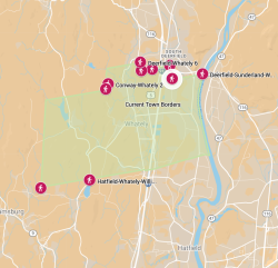
HIDDEN HISTORY invites you to explore the history of one small town in western Massachusetts by using our digital map. The Whately Historical Commission has drawn on historic documents, maps, photographs, newspaper articles, and objects of daily life to create this digital map [See Sources] We hope to enlighten and entertain Whately residents, descendants, visitors and historians alike.
 

Please send comments, constructive criticism, and suggested future material via email to historicalcommission@whately.org, with HIDDEN HISTORY in the subject line.  HIDDEN HISTORY is a work in progress, and we welcome your contributions!


What’s on the map?


Whately Corners

Each of Whately’s 20 corners was originally marked by a stone or concrete pillar. Until around 1980, the Selectmen used to ‘walk’ these markers every few years. We’ve inserted photographs and descriptions, updated from those in a 1914 state atlas, of the stones we have located. If you decide to visit them, remember that many stones are on private property, which may limit access.


1771

Town records list about 34 private residences in Whately in the year 1771, when Whately formally separated from Hatfield. We’ve marked the house locations and included photographs of those that remain standing on their original foundations, as well as a few early roads, neighborhoods, and structures.


Whately on Tap

The town has a spirited history of manufacturing alcoholic beverages – cider, brandy, gin and beer – that stretches from the 1750s right up to the present.


Whately at Work

We often think of agriculture when we think of Whately at work, but many other business enterprises have thrived over the years. These are but a few.


Whately at Play

Here we’ve included but a few examples of the entertainment and leisure activities in Whately, past and present.


Whately Firsts

Many of the services present-day Whately residents take for granted were first introduced during the 20th century.


Watch Your Step in Whately

Daily life in years past was fraught with dangers, without the protections and safety regulations that we count on today. We’ve included some of the more noteworthy documented accidents and events.


With special thanks to the Whately Historical Society, particularly archivist Dereka Smith, without whose generous support this project would not have been possible, and to Lynn Sibley, Assistant Town Clerk and Treasurer, for her time and advice in accessing historic town records.


Visit the Map

thumbnail of map

Visit: Hidden History Map


How to Use the Map


Please note: Hidden History is more accessible at this stage of its evolution on a computer than via a tablet or smartphone.


If you don’t immediately see a scattering of icons across the map of Whately, hit “Refresh” and wait a moment for the map to load.


You can choose to look at the whole map at once, or review the content layer by layer, by clicking or unclicking the major headings. You may wish to begin by clicking only Whately Corners and 1771, which will give you an indication of the shape of the Town 250 years ago.


You may open individual entries by clicking on an item in the drop-down menu on the left. Your chosen entry will open in the vertical bar on the left. You should see the text immediately. To review embedded photographs and newspaper clippings, double-click on the photographic image, which will take you to the images in full-screen size.


To return to the menu, click on the left-pointing arrow in the upper left-hand corner.